GEOGRAPHY CAREER OPTIONS
Bull's-Eye: Use the different 'SETTINGS' to Apply for Attachments & Internships in different career option.
NB: Attachment is OPTIONAL.
1. Urban Planner
Urban planners develop plans and programs for land use in urban areas. They assess community needs and create proposals for new developments, zoning, and public services to improve infrastructure and accommodate population growth.

SETTINGS:
- Government agencies (local, state, and federal)
- Private consulting firms
- Nonprofit organizations
- Real estate development companies
SKILLS:
- Negotiation: Ability to mediate between stakeholders with conflicting interests.
- Policy Analysis: Understanding of legal regulations and policy implications.
- Visualization: Proficiency in creating visual representations of data and plans.
2. Cartographer
Cartographers design and produce maps, charts, and other visual representations of geographic data. They gather, analyze, and interpret spatial data to create accurate and informative maps.

SETTINGS:
- Mapping companies
- Government agencies
- Educational institutions
- Geographic information systems (GIS) firms
SKILLS:
- Attention to Detail: Precision in depicting spatial data accurately.
- Artistic Sensibility: Ability to make maps visually appealing and user-friendly.
- Software Proficiency: Mastery of GIS and graphic design software like ArcGIS and Adobe Illustrator.
3. Geographic Information Systems (GIS) Analyst
GIS analysts manage spatial data using specialized software to analyze geographic data for a variety of applications, such as urban planning, environmental conservation, and disaster response.
SETTINGS:
- Environmental agencies
- Urban planning departments
- Research institutions
- Private companies and consultancies
SKILLS:
- Database Management: Expertise in handling large datasets and databases.
- Problem Solving: Ability to develop innovative solutions to spatial problems.
- Data Interpretation: Skill in understanding and explaining complex geographic data patterns.
4. Environmental Consultant
Environmental consultants advise on environmental issues, helping clients comply with regulations and develop strategies for sustainable development. They conduct assessments and provide solutions to minimize environmental impacts.

SETTINGS:
- Environmental consulting firms
- Construction and engineering companies
- Government agencies
- Nonprofit organizations
SKILLS:
- Regulatory Knowledge: Understanding of environmental laws and regulations.
- Risk Assessment: Ability to evaluate environmental risks and propose mitigation strategies.
- Technical Writing: Proficiency in documenting findings and recommendations clearly.
5. Climatologist
Climatologists study climate patterns and analyze data to understand climate change and its impact on the environment and human activity. They provide insights for policy-making and disaster preparedness.


SETTINGS:
- Research institutions
- Government weather services
- Universities
- Environmental NGOs
SKILLS
Statistical Analysis: Expertise in analyzing complex climate data sets.
Communication: Ability to explain scientific concepts to non-specialists.
Computational Skills: Proficiency in using climate modeling software and tools.
6. Conservation Officer
Conservation officers manage and protect natural resources and wildlife habitats. They enforce environmental laws, conduct field studies, and work on conservation projects.
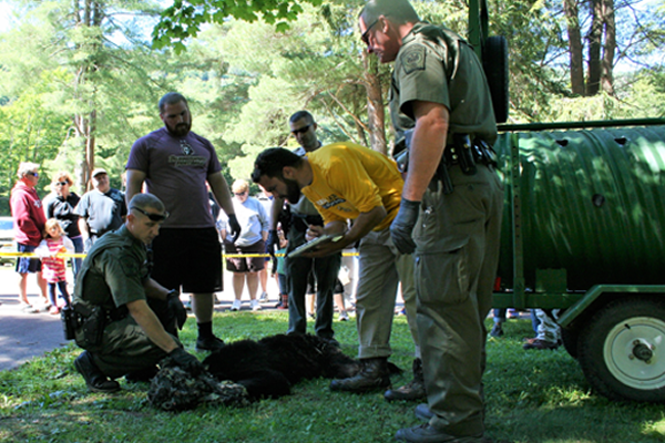
SETTINGS:
- National parks and wildlife reserves
- Government conservation agencies
- Environmental NGOs
- Research organizations
SKILLS:
- Conflict Resolution: Handling disputes between humans and wildlife or land use issues.
- Fieldwork Skills: Ability to conduct research in diverse and challenging environments.
- Ecological Knowledge: Understanding of ecosystems and biodiversity conservation.
7. Transportation Planner
Transportation planners develop plans to improve transportation systems and infrastructure. They analyze data, forecast travel trends, and propose solutions for traffic congestion and public transit systems.

SETTINGS:
- Government transportation departments
- Urban planning firms
- Engineering consultancies
- Public transit agencies
SKILLS:
- Forecasting: Predicting future transportation trends and needs.
- Public Engagement: Ability to interact with the public and gather input on transportation projects.
- Spatial Awareness: Understanding how transportation networks interact with geographic landscapes.
8. Remote Sensing Analyst
Remote sensing analysts use satellite or aerial imagery to gather information about the Earth's surface. They analyze data to support environmental monitoring, urban planning, agriculture, and disaster management.
SETTINGS:
- Research organizations
- Government agencies
- Environmental consultancies
- Aerospace and defense companies
SKILLS:
- Image Processing: Ability to interpret and analyze satellite images accurately.
- Technical Aptitude: Proficiency in using remote sensing software like ENVI or ERDAS Imagine.
- Analytical Thinking: Skill in identifying patterns and anomalies in imagery data.
9. Hydrologist
Hydrologists study the distribution, circulation, and properties of water in the Earth’s crust. They assess water resources and work on projects related to water quality, conservation, and management.
SETTINGS:
- Environmental agencies
- Research institutions
- Engineering firms
- Government departments
SKILLS:
- Numerical Modeling: Ability to simulate water flow and distribution.
- Field Techniques: Expertise in collecting and analyzing water samples.
- Communication: Explaining complex hydrological concepts to diverse audiences.
10. Geoscientist
Geoscientists study the Earth's structure, composition, and processes. They conduct research to understand geological phenomena and apply findings to resource management, environmental protection, and hazard mitigation.
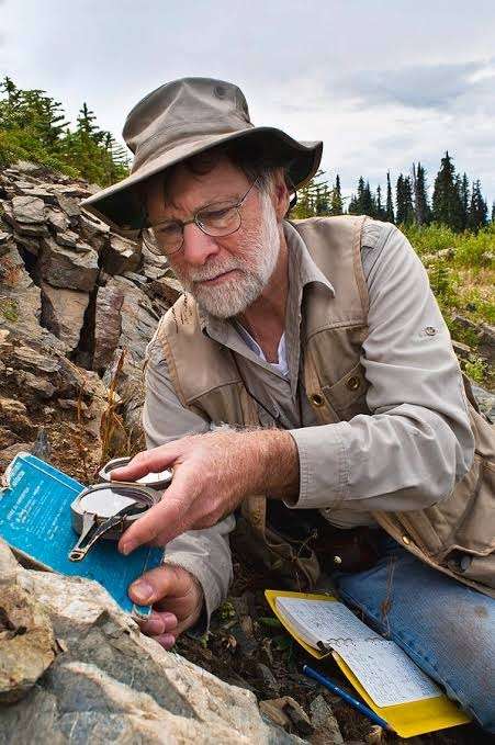
SETTINGS:
- Research institutions
- Oil and gas companies
- Mining firms
- Environmental consultancies
SKILLS:
- Research Design: Developing and conducting scientific studies and experiments.
- Fieldwork Expertise: Proficiency in geological mapping and sample collection.
- Critical Thinking: Ability to interpret geological data and form conclusions.
11. Demographer
Demographers analyze population data and trends to inform policy-making and planning. They study aspects such as birth rates, migration patterns, and demographic shifts to understand societal changes.
SETTINGS:
- Government agencies
- Research institutions
- NGOs
- Market research firms
SKILLS:
- Survey Design: Creating effective surveys to gather population data.
- Cultural Sensitivity: Understanding diverse cultural perspectives and their implications on demographic studies.
- Analytical Skills: Ability to identify and interpret demographic trends from complex data sets.
12. Location Analyst
Location analysts evaluate geographic data to determine optimal locations for businesses, retail stores, and services. They use spatial analysis to support strategic decision-making.

SETTINGS:
- Retail companies
- Real estate firms
- Logistics companies
- Consulting firms
SKILLS:
- Market Analysis: Understanding economic and demographic factors that affect location decisions.
- Strategic Thinking: Developing long-term plans based on spatial insights.
- Decision-Making: Ability to weigh multiple factors and make informed recommendations.
13. Environmental Educator
Environmental educators teach and promote awareness of environmental issues. They develop educational programs, conduct workshops, and engage communities in sustainable practices.

SETTINGS:
- Schools and universities
- Environmental NGOs
- Nature reserves and parks
- Community organizations
SKILLS:
- Curriculum Development: Designing educational materials and programs.
- Public Speaking: Engaging and educating diverse audiences effectively.
- Creativity: Developing innovative ways to communicate environmental concepts.
14. Disaster Risk Manager
Disaster risk managers develop and implement strategies to reduce the impact of natural disasters. They assess vulnerabilities, coordinate emergency responses, and work on preparedness plans.

SETTINGS:
- Government emergency management agencies
- Humanitarian organizations
- Insurance companies
- International organizations
SKILLS:
- Crisis Management: Ability to remain calm and make decisions under pressure.
- Interdisciplinary Knowledge: Understanding of geography, sociology, and engineering principles.
- Community Engagement: Building relationships with local communities to improve resilience.
15. Real Estate Analyst
Real estate analysts evaluate properties and markets to provide insights for investment decisions. They conduct market research, assess property values, and identify trends affecting real estate dynamics.

SETTINGS:
- Real estate firms
- Investment companies
- Financial institutions
- Development companies
SKILLS:
- Market Research: Understanding of economic indicators affecting real estate.
- Quantitative Analysis: Proficiency in analyzing financial data and property valuations.
- Negotiation Skills: Ability to negotiate property deals effectively.
16. Tourism Development Officer
Tourism development officers plan and promote tourism strategies to attract visitors. They work on developing sustainable tourism projects, enhancing visitor experiences, and supporting local economies.

SETTINGS:
- Government tourism departments
- Hospitality companies
- Travel agencies
- NGOs focusing on sustainable tourism
SKILLS:
- Marketing Strategies: Developing promotional campaigns for tourism.
- Cultural Awareness: Understanding and respecting local cultures and traditions.
- Networking: Building partnerships with stakeholders in the tourism industry.
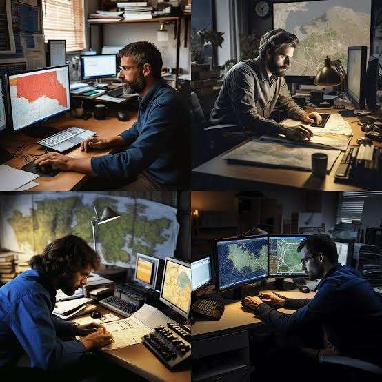
17. Geospatial Software Developer
Geospatial software developers create applications and tools for managing and analyzing geographic data. They work on developing GIS applications, mapping tools, and spatial databases.

SETTINGS:
- Technology companies
- GIS firms
- Research institutions
- Government agencies
SKILLS:
- Programming Proficiency: Expertise in coding languages like Python, JavaScript, or C++.
- User Experience Design: Ability to design intuitive interfaces for geospatial applications.
18. Geography Teacher/ Lecturer
Teaches Geography studies
SETTINGS
Highschool, Universities & colleges
NB: DO (Postgraduate Diploma In Education, PGDE)